Hide menu
COMPS
Individual
National teams
Classic classes tasks and task results
PF and PL tasks and task results
More PPG Photos
Links to photos and other stuff
Classics photos
PF & PL winners
The opening
PPG photos
The winners
Driving to the championships
Flying to the championships
Notams
Circuit pattern
Insurance
Entry forms (2)
Weather
Ferry Bookings
Flags and Anthems
Bulletin 1
Anti-doping
Notams
Trade Fair
Hotels
Location
Official logo
Site photos
Rules
Flight recorders
Team sizes
Fuel measurement
Bank details
Maps
Weight policy
 Maps for the Classic Classes and class PL2
The official map will be Sheet 8 ENGLAND SOUTH 1:250,000 topographical air map of the United Kingdom, edition 7. (Published Feb 2003). - The map Datum is WGS 84 - The magnetic variation is 3.5° W - The map projection is 'British National Grid' |
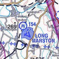
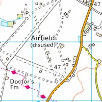 Maps for classes PPG & PL1 Maps for classes PPG & PL1The official maps will be the UK Ordnance Survey 1:50,000 'Landranger' maps Nos. 150 "Worcester and the Malverns" and 151 "Stratford-upon-Avon". For the purposes of airspace information the official Classic classes map will be used. - The map datum is Ordnance Survey Great Britain. - The magnetic variation is 3.5° W - The map projection is 'British National Grid' It is --only-- possible to extract WGS84 positions from the 1:50,000 map by transforming OS grid references to lat-lon mathematically. An explanation of OS grid references is on each map. A spreadsheet to do the conversion calculations as well as more info about this is available on the BMAA records website. |
Map supply All competitors will be provided with maps as part of their entry fee. If you wish to purchase maps in advance, there are various online stores which usually stock these maps. Some suggestions: 1:250,000 Topographical air map: Pooleys, Transair Ordnance Survey 1:50,000 'Landranger' maps: National Map Centre |
10 Mar 2003
Site design by