
Championship mascot
Press Conference
Championship song
Your arrival
Tour info
Customs
3rd Party Insurance
More about flight recorders
Flights to Beijing
Location
Graphics
Accommodation
Weather
Hotel reservation form (pdf)
Hotel reservation form (doc)
Local regulations and task catalogue
Bulletin No 1 (pdf)
Entry form (pdf)
Letter of invitation (pdf)

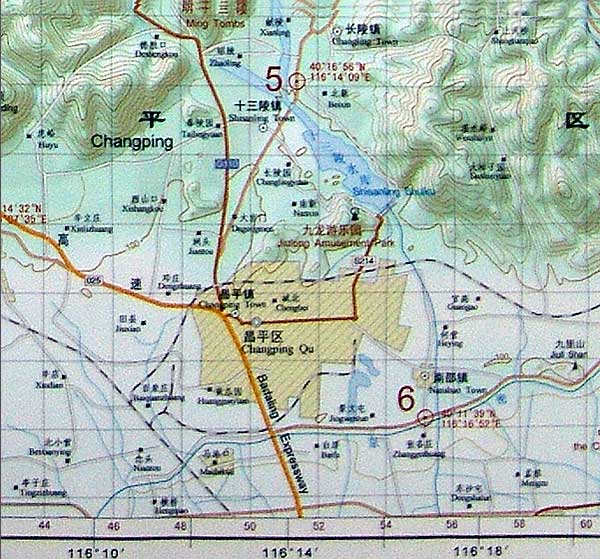
 Maps
MapsThe maps issued to pilots will look like the one below.
Scale is 1:100,000, the grid is 2Km x 2Km
Note the lake is shown to its fullest possible extent and will be as it appears in the satellite image.
27 Jun 2007
Problems with this page? Contact: Site design by